Contents
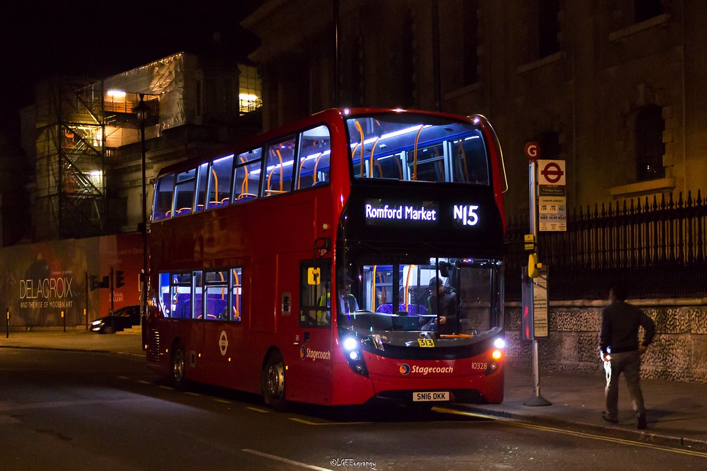
Blue Triangle Bus Service N15 (Route) from Romford Market to Oxford Circus – Time Schedules, Stops, Route Maps, Directions, Website
![]()
Operator: Blue Triangle
Website: tfl.gov.uk/bus/route/n15
N15 Bus Route Directions and Bus Stop
Romford Market – Margaret Street / Oxford Circus
| E- Romford Market | F- North Street | LL- Stepney Methodist Church |
| K- Mercury Gardens | Z- Barking Tesco | LM- Marion Richardson School |
| Q- Western Road | R- Burges Road | Exmouth Estate |
| T- Romford Station | S- St Olave’s Road | St Mary’s & St Michael’s Church |
| C- Thurloe Gardens | T- Altmore Avenue | E- Watney Market |
| D- Brentwood Road | W- Newham Town Hall | T- New Road |
| RZ- Clydesdale Road | Q- Bartle Avenue | U- Henriques Street |
| RU- Norwood Avenue | Aintree Avenue | J- Aldgate East Station |
| J- Rush Green Road / Dagenham Road | Dickens Road | R- Aldgate Station |
| K- Leonard Avenue | Y- Upton Park / Priory Road | H- Minories |
| L- Clayton Road | P- Upton Park / Green Street | TA- Tower of London |
| M- Barton Avenue | S- New City Road | TT- Great Tower Street |
| P- Cu London University / Wood Lane | BA- Plaistow / Prince Regent Lane | J- Monument Station |
| H- Becontree Heath Leisure Centre | BB- Plaistow Police Station | MA- Cannon Street Station |
| E- Morris Road | BC- Balaam Street | SH- St Paul’s Churchyard |
| L- Five Elms School | BD- Chargeable Lane | SJ- St Paul’s Cathedral |
| M- Boxoll Road | BE- Croydon Road | F- City Thameslink Stn / Ludgate Circus |
| WR- Beverley Road | P- Rokeby School | H- Shoe Lane |
| WS- Martins Corner / Valence Avenue | M- Hermit Road | W- Fetter Lane |
| WU- Bennetts Castle Lane | N- Rathbone Market | W- Chancery Lane |
| UA- Lindsey Road | G- Canning Town Bus Station | P- The Royal Courts of Justice |
| UB- Lodge Avenue | Abbott Road | G- Aldwych / Australia House |
| UC- St. Thomas More Catholic Church | D- Blackwall Tunnel | R- Aldwych / Drury Lane |
| UD- Capel Gardens | A- Bazely Street | U- Savoy Street |
| UG- Thurlestone Avenue | E- Poplar Recreation Ground | J- Bedford Street |
| BK- Barking Bus Garage | F- Upper North Street | H- Charing Cross Station |
| BP- Faircross | WZ- University of Cumbria In London | T- Trafalgar Square |
| BR- Hulse Avenue / Barking Park | WT- Burdett Road | Y- Regent Street / St James’s |
| WB- Park Avenue | LH- Limehouse Town Hall | E- Piccadilly Circus |
| N- Barking Station | LJ- Lowell Street | L- Beak Street / Hamleys Toy Store |
| C- Barking Town Centre | LK- Limehouse Station | Oxford Circus Station |
List of Bus Routes / Services in London
View the List of Bus Routes / Services in London address, phone number, email and website through the link.
Oxford Circus Stn / Margaret Street – Romford Market
| RF- Oxford Circus Stn / Margaret Street | LE- Burdett Road | P- North Street |
| RG- Oxford Circus | WS- University of Cumbria In London | E- Barking Town Centre |
| V- Beak Street / Hamleys Toy Store | C- Upper North Street | K- Barking Station |
| F- Piccadilly Circus | D- Poplar Recreation Grd / Poplar Stn | EB- Park Avenue |
| R- Haymarket / Jermyn Street | B- Chrisp Street Market | BA- Hulse Avenue / Barking Park |
| B- Trafalgar Square | C- Bazely Street | BB- Faircross |
| F- Charing Cross Stn / Trafalgar Square | E- Brunswick Road | BC- Barking Bus Garage |
| A- Southampton Street / Covent Garden | F- Nutmeg Lane | UE- Thurlestone Avenue |
| D- Aldwych | E- Abbott Road | UF- Capel Gardens |
| L- The Royal Courts of Justice | H- Stephenson Street | UH- St. Thomas More Catholic Church |
| E- Fetter Lane | F- Canning Town Bus Station | UI- Becontree Avenue |
| E- Ludgate Circus | J- Rathbone Market | UJ- Lindsey Road |
| G- Ludgate Hill / Old Bailey | L- Hermit Road | EC- Bennetts Castle Lane |
| SK- St Paul’s Cathedral | S- Rokeby School | EE- Martins Corner / Valence Avenue |
| ME- Mansion House Station | BH- King Street | EH- Charlecote Road |
| MB- Cannon Street Station | BJ- Balaam Street | N- Winmill Road |
| H- Monument Station | BK- Plaistow Police Station | K- Heathway |
| TU- Great Tower Street | BM- Plaistow / Prince Regent Lane | C- Morris Road |
| TB- Tower of London | BN- New City Road | G- Becontree Heath Leisure Centre |
| S- Mansell Street | T- Samson Street | R- Cu London University / Wood Lane |
| H- Aldgate East Station | O- Upton Park / Green Street | A- Barton Avenue |
| P- Henriques Street | Q- Upton Park / Priory Road | B- Clayton Road |
| Q- New Road | W- Arragon Road | C- Leonard Avenue |
| F- Watney Market | Katherine Road | D- Dagenham Road |
| St Mary’s & St Michael’s Church | P- Bartle Avenue | RW- Norwood Avenue |
| Arbour Square | S- High Street North | RX- Clydesdale Road |
| LA- Stepney Methodist Church | O- Newham Town Hall | J- Brentwood Road |
| LB- Limehouse Station | X- Altmore Avenue | V- Romford Station |
| LC- Lowell Street | W- St Olave’s Road | PP- Western Road |
| LD- Salmon Lane | V- Burges Road | L- Romford Market |
N15 Route Map

Useful Links
N15 Gallery

Is there any problem/complaint with reaching the Blue Triangle Bus Service N15 (Route) from Romford Market to Oxford Circus? Please report any issues using the below comment form.
Rate your experience with the Blue Triangle Bus Service N15 (Route) from Romford Market to Oxford Circus: (click on the stars below)Click to rate this post!
[Total: 0 Average: 0]